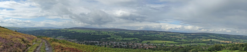

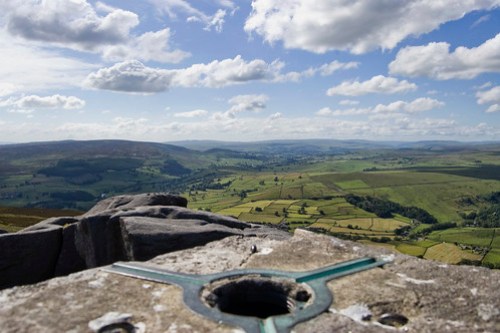
Trigpoints are the common name for “triangulation pillars” the UK mapping and triangulation system before GPS and Google Earth. There is a great Trigpoint website with map references pictures and search facilities. ‘These are concrete pillars, about 4’ tall, which were used by the Ordnance Survey in order to determine the exact shape of the country. They are generally located on the highest bit of ground in the area, so that there is a direct line of sight from one to the next. By sitting a theodolite (an accurate compass built into a telescope) on the top of the pillar, accurate bearings to nearby trigpoints could be taken. This process is called “triangulation”.
A major project to map out the shape of Great Britain began in 1936. The network of triangulation pillars, with accurately known positions, led to the excellent OS maps which we enjoy today. The coordinate system used on these maps is known as the “National Grid”, and it is essential that you are familiar with this system if you are to get the most of OS maps, or this website. ‘

A selection of trig points in Hull
.7 arrow Leads Bridge TP4385 HULL TA106322 Map Secondary Pillar Possibly missing
5.5 arrow Haltemprice TP3578 HULL TA038308Map none Secondary Pillar Good condition
6.0 arrow East Mount TP2992 HULL TA135328Map none Secondary Pillar Good condition
6.9 arrow East Marsh TP2991 HULL TA139242Map none Secondary Pillar Good condition
7.4 arrow Ganstead Farm TP3301 HULL TA141342Map none Secondary Pillar Good condition
8.3 arrow Barton Waterside TP0357 BARTON-UPON-HUMBER TA028234Map Passive station none Surface Block Possibly missing
10.2 arrow Paull Holme (New) TP5328 HULL TA183248Map none Secondary Pillar Good condition
10.8 arrow Deepdale TP2753 BARTON-UPON-HUMBER TA055187Map none Secondary Pillar Good condition

Collect your trig points and send us a photo.

It can be good fun seeking out trig points or making them the focus of your walk.
Beware the Trigs that hide behind walls

Map of a Nation: A Biography of the Ordnance Survey by Rachel Hewitt

Cold enough to turn the sky blue

Other Yorkshire Trig Point Photo Credits
Brimham Rock “Triangulated by westy48, CC BY-SA 2.0
Ovenden Moor trig point by tricky (rick harrison) CC BY-NC-SA 2.0
The Valley of Desolation by tj.blackwell CC BY-NC 2.0
At the sumit of Whernside by Bods CC BY-SA 2.0
Trig point 4643 by Richard Carter (Calderdale) CC BY-NC-SA 2.0

Latest book from amazon Walking the County High Points of England by David Bathurst
Pingback: Enjoy Enjoy Enjoy | Yorkshire - God's Own County